This article is part of FT Globetrotter’s guide to New York City
New York City can be hard for road cyclists to love: its drivers are aggressive and often appear unaware that they are supposed to share the road with those on two wheels; tyres frequently fall victim to broken glass and debris; unprotected cycle lanes do double duty as delivery drop-off zones or extra parking.
But my Lycra brethren are nothing if not determined, and their numbers in New York are growing. They can be found honing their fitness with laps on the vehicle-free Central Park loop (9.8km) and its smaller (and some would say better) Brooklyn sibling, Prospect Park (5.4km). Both are excellent for midweek pre- or post-work training rides.
Whenever possible, however, New York’s road cyclists look further afield. For while the city can be less than optimal for bike riders — the frustration of the constant stop-start of traffic lights on every block cannot be overestimated — getting out of Gotham can be a joy.
Here are four routes for experienced cyclists that are best done on a road bike and can be completed within a few hours, depending on your speed. They range from semiurban and short and flat to longer and rural with more climbing.
A couple of rules of the road (even if locals do not always follow them): in New York City, cyclists can go through a red light if pedestrians have a “walk” signal, but outside the city they must stop until the light changes. They are also required to yield to pedestrians on all crossings.
Route 1: Brooklyn to Rockaway Beach and back
Distance: 53.8km; elevation, 125m
Good for: Quick access to the sea
Not so good for: Quiet countryside
FYI: There are fast food places along the boardwalk at Rockaway Beach


Amid the urban madness of New York City, it can be easy to forget that there are great beaches on your doorstep. Rockaway Beach in the borough of Queens has acres of sand and a famous boardwalk, and cycling there feels like going on a short holiday. This is a partly urban, easy ride beginning at the Brooklyn Public Library on Grand Army Plaza, a monumental traffic oval with a triumphal arch commemorating the fallen of the Civil War.
The route takes you via a cycle path along Eastern Parkway, a grand boulevard designed in the 19th century by Frederick Law Olmsted and Calvert Vaux, the landscape designer and architect duo responsible for Central Park and Prospect Park. It then continues along a stretch of busy traffic through the ethnically diverse neighbourhoods of Brownsville and Canarsie before entering the good-natured chaos of the waterfront park at Canarsie Pier.
At the park the route joins the Shore Parkway Greenway, a separated cycle-pedestrian lane that hugs the shoreline of Jamaica Bay. Despite the proximity to the multi-lane Shore Parkway, it is surprisingly peaceful, with some great views over the water. A circuit of Shirley Chisholm State Park — a short paved loop on reclaimed land — allows you a close-up view of the water and the birdlife that thrives there.
The greenway eventually sends you through Howard Beach and on to Cross Bay Boulevard, a wide highway with a protected bike lane that rises high over Jamaica Bay. Anglers can usually be seen tending their rods on your right as you cycle down into Broad Channel, the only inhabited island in Queens, where the residential streets resemble piers and the houses have ladders down to boats instead of back gardens.
From there you climb over the water once again and down into Rockaway, where the route eventually funnels you on to the famous boardwalk, with families strolling and teenagers posing next to the sand as cyclists and rollerbladers weave past. A stretch along a pleasant boulevard away from the water leads to the seafront at Jacob Riis Park, named after a 19th-century Danish-American social reformer, with benches overlooking the wide expanse of beach, where you can have a cooling dip.
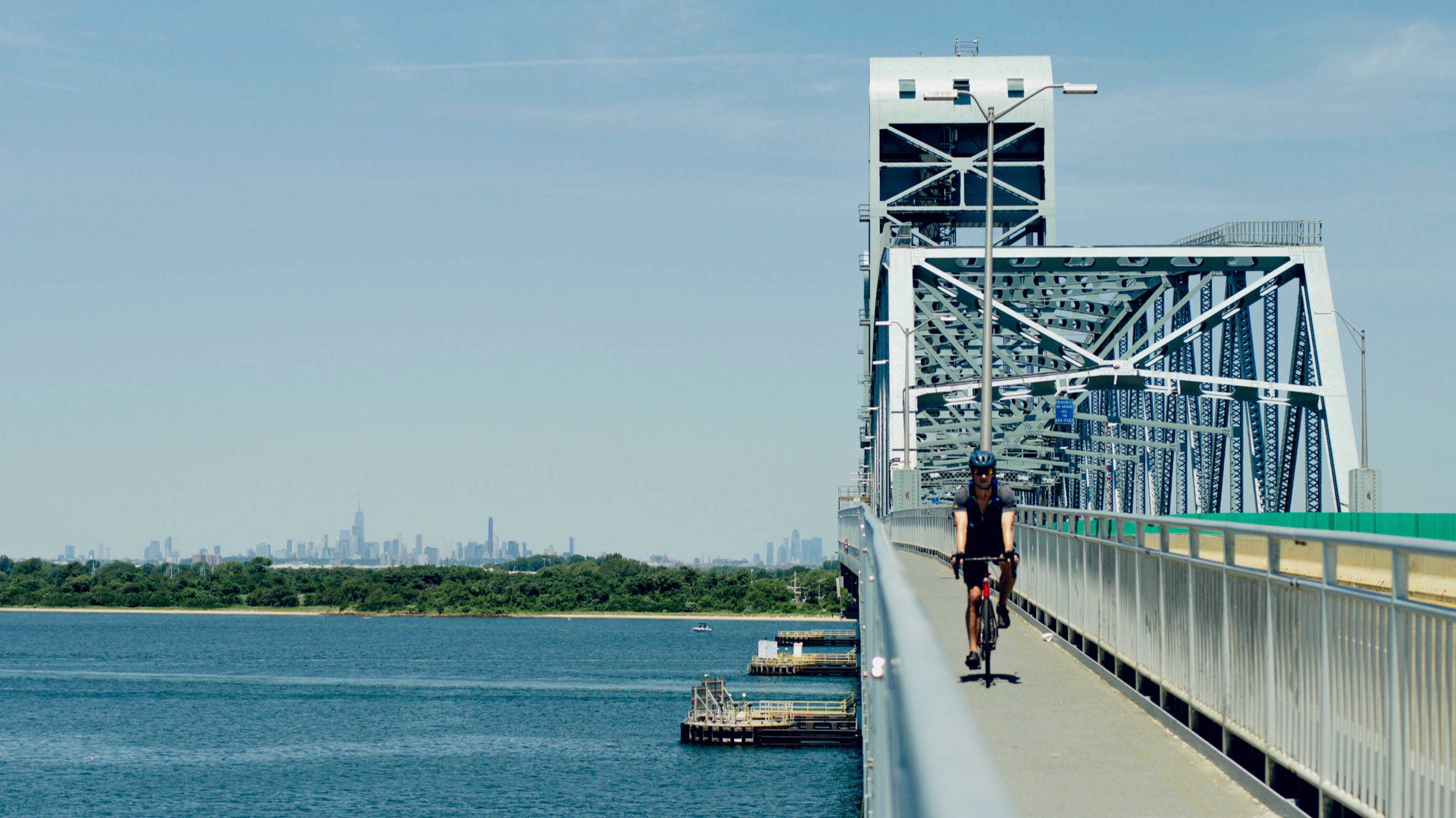
A narrow lane then takes you over Marine Parkway Bridge, with its spectacular views of the Manhattan skyline, after which the route rejoins the greenway to Canarsie Pier and back to the Brooklyn Public Library.
This link to the route can be downloaded to your smartphone or bike computer
Route 2: Tour of Staten Island
Distance: 60km; elevation, 282m
Good for: Views of Manhattan and the sea
Not so good for: Hill climbs
FYI: There is very little separated cycle infrastructure but roads are reasonably quiet


It’s easy to forget that the island off the southern tip of Manhattan is one of New York City’s five boroughs. So strictly speaking, this route does not get you out of the city, but the quiet streets of Staten Island have a small-town feel. This easy route around the island avoids crowds and takes you into one of the least-visited parts of New York.
To get there, take the Staten Island Ferry, which is free and easily accessible to those on bicycles (and offers unparalleled views of the Statue of Liberty and the south Manhattan skyline). From the pier, a cycle lane takes you west on to a road with cycle markings.
The road, which is quiet at the weekend, initially runs past warehouses and light industrial units before eventually turning in through some residential streets then skirting and passing through Freshkills Park. This was once the site of a notorious landfill site, but is now the largest park to be developed in the city for over a century, though much of it is still closed to the public. The word “kill” is derived from the Dutch for inlet or creek and the area is filled with small waterways.


As you head towards the southern tip of the island, a greenway goes through lush parkland, past small creeks teeming with bird and wildlife, and then onwards to Robinson’s Beach, a sandy enclave with views over Raritan Bay to New Jersey.
The route loops through residential areas and under the Verrazzano-Narrows Bridge, which opened in 1964 and has a bigger suspension span than San Francisco’s Golden Gate Bridge. Not far from the ferry port, it takes you back on to the water beside a rail yard, with excellent views over southern Brooklyn and beyond to the Manhattan skyline.
Downloadable link to this route here
Route 3: Nyack loop
Distance: 123km; elevation, 851m
Good for: Getting up some speed
Not so good for: Novice cyclists
FYI: Leave early at the weekend to avoid the crowds

This is a perennial favourite for New York road cyclists looking to test their stamina and offers spectacular views, as well as rolling hills and varied terrain. It’s best to start before 8am at the weekend to avoid the crowds as you leave Manhattan.
The route starts at Chambers Street and heads north on the Hudson River Greenway, the excellent cycle and running lane that abuts Hudson River Park, a triumphant revitalisation of the city’s once-derelict waterfront. On the Upper West Side the route runs directly alongside the river, with great views across to New Jersey.
Just before heading over the George Washington Bridge, spectacular views of the Manhattan skyline can be found near the Little Red Lighthouse, which was decommissioned in 1947 and is now a New York City landmark.
After crossing the Hudson, the route takes you into Palisades Interstate Park and along Henry Hudson Drive, a magical 13km road through rolling tree-lined hills that is open from mid-April to mid-November and has scant vehicle traffic.
The route then leads out on to gently rolling hills on Highway 9W, with a wide shoulder that is used by cyclists. About 10km after you join the highway you pass 9W Market, the refuelling spot of choice for New York’s road-cycling fraternity, where you can find strong coffee, baked goods or more substantial meals.
From there, a pretty tree-lined road takes you along a creek to the shore of the Hudson River and through the picturesque community of Piermont and into Nyack, birthplace of Edward Hopper.
If you need to refuel before heading back over the river, the vibrant village centre is filled with restaurants, ranging from fast food to more formal eateries, or you can carry on along North Broadway Street past some very grand houses to Nyack Beach State Park for a rest on the river shore.
You then go back across the Hudson on the Tappan Zee Bridge to join the South County Trailway, part of the excellent Empire State Trail, a 1,200km, mostly paved shared cycling and pedestrian path that is 70 per cent separated from traffic and stretches from Manhattan to the Canadian border.
This section of the trail hugs the Saw Mill River Parkway, passing beside villages and suburbs before entering Van Cortlandt Park in the Bronx. From there, the route passes through a brief stretch of urban traffic chaos on Broadway in order to cross the Harlem River into Manhattan and return to quiet back streets before eventually rejoining the Hudson River Greenway.
Downloadable link to this route here
Route 4: Oyster Bay loop
Distance: 108km; elevation, 847m
Good for: Beautiful scenery
Not so good for: Avoiding steep hills
FYI: Don’t be put off by the first few kilometres

The mansions of Long Island’s north shore — known as the Gold Coast — inspired F Scott Fitzgerald’s The Great Gatsby. This route rolls through lush hills dotted with large properties that give you a hint of that storied past.
To avoid cycling along unpleasant urban roads, the starting point is the Kew Gardens-Union Turnpike subway station (bikes are allowed on the subway, but best to avoid rush hour). Don’t be discouraged by the unpromising start — the first time I did this, I thought I was being funnelled on to a highway as I gingerly went down a garbage-strewn cycle “lane”. But five minutes in, the route leads you through quiet roads in suburban Queens and on to a patch of separated cycle greenway, then out to more rural terrain via a pretty fast, if not very picturesque, stretch of service road hugging the Long Island Expressway.
From here, the route skirts Long Island neighbourhoods, including North Hills and Roslyn Heights, that gradually give way to rolling hills on sylvan rural roads punctuated by long driveways leading to very large houses. Eventually a left turn takes you down along the picturesque waterfront of Cold Spring Harbor, originally a 19th-century whaling settlement that later became a resort. The road overlooks the sailing boats in the harbour and is lined with upscale restaurants and small boutiques.

Continuing out of the hamlet, you weave back up into the surrounding hills through the settlement of Huntingdon Station and down towards the water, then up Moores Hill Road, about a quarter of which has a gradient of 10 to 15.5 per cent. A right turn then takes you on a welcome winding descent into the town of Oyster Bay. A settlement was first established here in the mid-17th century, when Europeans bought land from the native Matinecock tribe. With quiet streets, quaint 19th-century architecture and a large yacht club, it’s a great spot to enjoy lunch at one of the many small restaurants on Main Street before heading back into the city via the lush farmland and wooded hills of Matinecock and Upper Brookville and rejoining the outbound route.
Downloadable link to this route here
Read more of our New York guide here, from a guide to grown-up partying to fashion designer Nili Lotan’s Tribeca, Lilia chef Missy Robbins’s favourite restaurants and where to drink wine, see and buy textiles, eat after hours, get a men’s haircut and shop for women’s shoes. You’ll find food tours of Flushing, Queens and Red Hook, Brooklyn, a peek behind the scenes at The Mark Hotel before The Met Gala, an ode to the city’s backgammon subculture and some great routes to Citi Bike across the boroughs
Follow us on Instagram at @FTGlobetrotter
Cities with the FT
FT Globetrotter, our insider guides to some of the world’s greatest cities, offers expert advice on eating and drinking, exercise, art and culture — and much more
Find us in New York, London, Tokyo, Washington DC, Paris, Los Angeles, Lagos, Rome, Frankfurt, Singapore, Hong Kong, Miami, Toronto, Madrid, Melbourne, Copenhagen, Zürich, Istanbul, Milan, Vancouver, Edinburgh and Venice